EARTH SCIENCE
Platte Canyon High
School
Bailey, Colorado

PCHS Topographic Map and Aerial Photo
main page
|
EARTH SCIENCE |
Platte Canyon High
School |
|
|
PCHS Topographic Map and Aerial Photo |
| ========================================================= | |
| ================================================= | |
|
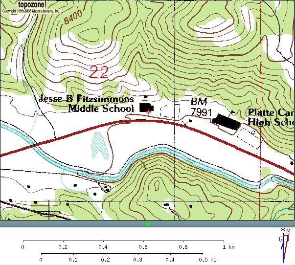
Topographic Map |
 |
|
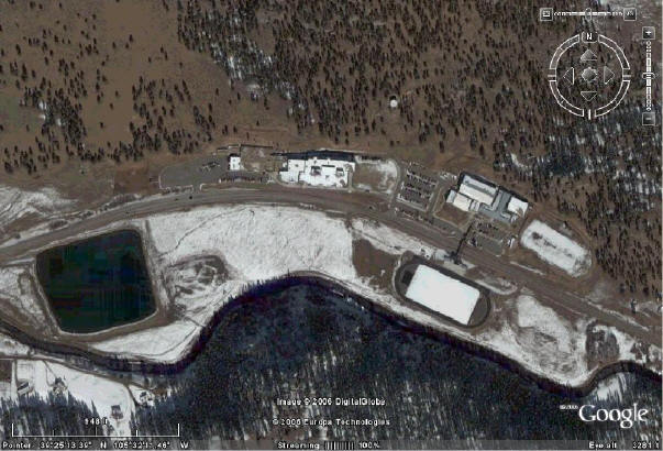
Aerial Photo |
 |